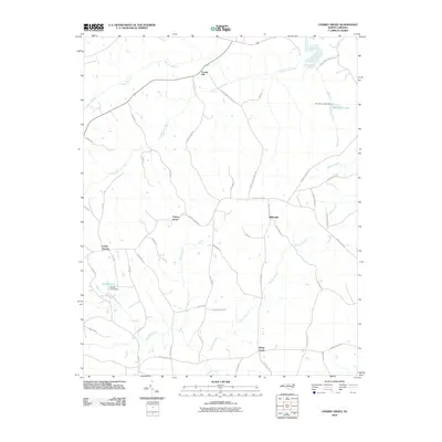
2010 Map of Cherry Grove
USGS Topo · Published 2010About this map
Locust Hill and Cherry Grove anchor a landscape defined by traditional Piedmont farmsteads and a network of named family roads. The area is characterized by its intricate drainage system, where the waters of Country Line Creek and Nats Fork shape the terrain. This 2010 survey illustrates the rural community structure of Caswell County just after the turn of the millennium, showing a transition between agricultural open space and small residential clusters like Camp Springs and Millesville.
Find a feature on this map
49 named features on this map. Tap any name to fly to it.
Don’t see what you’re looking for? This feature index may not catch every label — zoom into the map to look around manually.
Map Details
Editions of this 2010 Cherry Grove Map
This is the sole edition of this map. No revisions or reprints were ever made.
Other maps of this area

1953 · Greensboro
USGS Topo · 1:250,000

1954 · Greensboro
USGS Topo · 1:250,000

1962 · Greensboro
USGS Topo · 1:250,000

1966 · Greensboro
USGS Topo · 1:250,000

1969 · Lake Burlington
USGS Topo · 1:24,000

1969 · Burlington NE
USGS Topo · 1:24,000

1970 · Ossipee
USGS Topo · 1:24,000
1971 · Ruffin
USGS Topo · 1:24,000
1972 · Anderson
USGS Topo · 1:24,000
1972 · Williamsburg
USGS Topo · 1:24,000