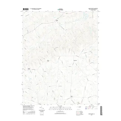
2016 Map of Cherry Grove
USGS Topo · Published 2016About this map
Locust Hill and the surrounding rural landscapes of Caswell County are characterized by a network of creeks and small airfields in this recent survey. The terrain is defined by the drainage systems of Country Line Cr and Stony Cr, which flow through a topography rising to Stony Creek Mtn. Small communities like Cherry Grove, Millesville, and Camp Springs are connected by a dense grid of named country roads, including Bethesda Church Rd and Kerrs Chapel Rd, which often follow the local ridges. Private aviation is a visible part of the local economy and transport, evidenced by the K & D Airport and the H & J Strip. Recreational water bodies such as Boy Scout Lake, Williams Lake, and Butler Pond dot the landscape, suggesting the continued importance of these features for local recreation and land management in the modern era.
Find a feature on this map
73 named features on this map. Tap any name to fly to it.
Don’t see what you’re looking for? This feature index may not catch every label — zoom into the map to look around manually.
Map Details
Editions of this 2016 Cherry Grove Map
This is the sole edition of this map. No revisions or reprints were ever made.
Other maps of this area

1953 · Greensboro
USGS Topo · 1:250,000

1954 · Greensboro
USGS Topo · 1:250,000

1962 · Greensboro
USGS Topo · 1:250,000

1966 · Greensboro
USGS Topo · 1:250,000

1969 · Lake Burlington
USGS Topo · 1:24,000

1969 · Burlington NE
USGS Topo · 1:24,000

1970 · Ossipee
USGS Topo · 1:24,000
1971 · Ruffin
USGS Topo · 1:24,000
1972 · Anderson
USGS Topo · 1:24,000
1972 · Williamsburg
USGS Topo · 1:24,000