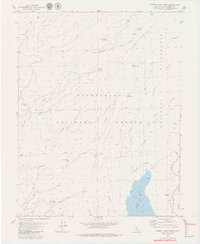
1979 Map of Cherry Lake North
USGS Topo · Published 1979About this map
Cherry Lake Spillway dominates the southeastern corner of this 1970s topographical study, marking a significant hydrological point where Cherry Creek flows southward toward the Yosemite National Park boundary. The landscape is defined by the high-altitude drainages of the Clavey River and Bourland Creek, which carve through a terrain characterized by numerous meadows like Bourland Meadow and Weed Meadow. This map documents a wilderness in transition, where the Emigrant Wilderness and Stanislaus National Forest intersect.
Find a feature on this map
38 named features on this map. Tap any name to fly to it.
Don’t see what you’re looking for? This feature index may not catch every label — zoom into the map to look around manually.
Map Details
Editions of this 1979 Cherry Lake North Map
2 editions found
Other maps of this area

1891 · Big Trees
USGS Topo · 1:125,000

1893 · Sonora
USGS Topo · 1:125,000

1894 · Big Trees
USGS Topo · 1:125,000

1896 · Dardanelles
USGS Topo · 1:125,000

1896 · Sonora
USGS Topo · 1:125,000

1897 · Sonora
USGS Topo · 1:125,000

1897 · Big Trees
USGS Topo · 1:125,000

1897 · Yosemite
USGS Topo · 1:125,000

1898 · Dardanelles
USGS Topo · 1:125,000

1898 · Sonora
USGS Topo · 1:125,000