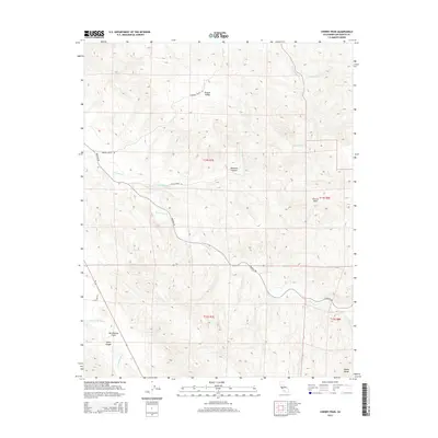
2015 Map of Cherry Peak
USGS Topo · Published 2015About this map
San Andreas Fault traces a prominent line through this section of the Diablo Range, defining the structural character of the landscape southeast of Hollister. The terrain is marked by the deep drainage patterns of Tres Pinos Cr and the San Benito River, which cut through a network of canyons and valleys. Settlement is sparse, characterized by winding rural routes like Panoche Rd and Browns Valley Rd that follow the natural contours of Browns Valley and McKenna Canyon. The map provides a detailed view of the high ridges leading toward Cherry Peak, where the complex geology of the fault zone meets the watercourses of Los Muertos Cr and Quien Sabe Cr. This record of the interior Coast Ranges captures the enduring ranching and topographic character of the region.
Find a feature on this map
21 named features on this map. Tap any name to fly to it.
Don’t see what you’re looking for? This feature index may not catch every label — zoom into the map to look around manually.
Map Details
Editions of this 2015 Cherry Peak Map
This is the sole edition of this map. No revisions or reprints were ever made.
Other maps of this area

1919 · San Benito
USGS Topo · 1:62,500

1919 · Hollister
USGS Topo · 1:48,000

1921 · Gonzales
USGS Topo · 1:62,500

1921 · Hollister
USGS Topo · 1:62,500

1922 · Quien Sabe
USGS Topo · 1:62,500

1923 · Hollister
USGS Topo · 1:62,500

1931 · San Benito
USGS Topo · 1:62,500

1940 · Hollister
USGS Topo · 1:62,500

1940 · Quien Sabe
USGS Topo · 1:62,500

1940 · San Benito
USGS Topo · 1:62,500