1923 Map of Hollister
USGS Topo · Published 1955About this map
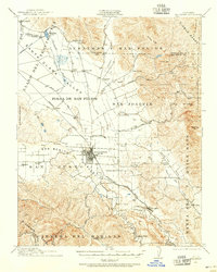
Hollister serves as the focal point of this 1923 culture revision, situated at the heart of the San Justo Valley. The town's grid is bisected by the Southern Pacific Railroad, which also connects outlying points like Dunneville and Tres Pinos. The landscape is defined by its agricultural land grants and valleys, including the Bolsa de San Felipe and the Llano del Santa Clara Valley, which are framed by the Diablo Range to the northeast and the Gabilan Range to the southwest.
Find a feature on this map
60 named features on this map. Tap any name to fly to it.
Don’t see what you’re looking for? This feature index may not catch every label — zoom into the map to look around manually.
Map Details
Editions of this 1923 Hollister Map
This is the sole edition of this map. No revisions or reprints were ever made.
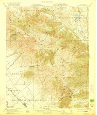
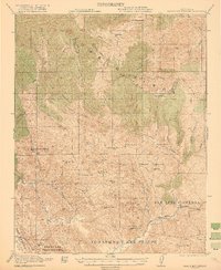
Other maps of this area

1910 · Salinas
USGS Topo · 1:31,680

1912 · Salinas
USGS Topo · 1:62,500

1915 · San Juan Bautista
USGS Topo · 1:48,000

1917 · Morgan Hill
USGS Topo · 1:62,500

1917 · San Juan Bautista
USGS Topo · 1:62,500

1919 · San Benito
USGS Topo · 1:62,500

1919 · Hollister
USGS Topo · 1:48,000

1920 · Pacheco Pass
USGS Topo · 1:62,500
1921 · Gonzales
USGS Topo · 1:62,500
1921 · Gilroy Hot Springs
USGS Topo · 1:62,500