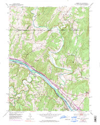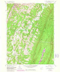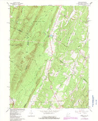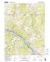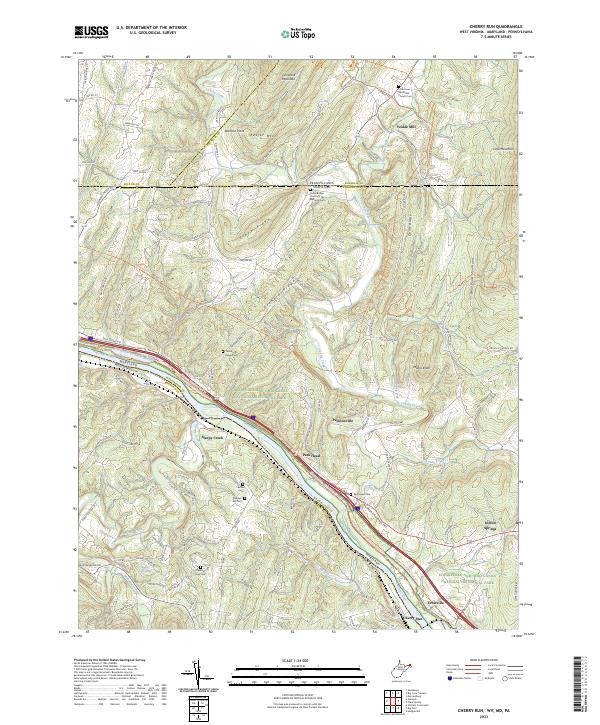
2023 Map of Cherry Run
USGS Topo · Published 2023About this map
Potomac River defines the border between Maryland and West Virginia, carving a winding path through the tri-state region where the ridges of the Appalachian Mountains converge. The landscape is defined by parallel heights like Tuscarora Mountain and Elbow Ridge, which dictate the flow of Licking Creek and Little Cove Creek. This modern survey highlights the enduring legacy of 19th-century infrastructure, particularly the Chesapeake and Ohio Canal corridor. Local history is deeply rooted in small crossroads such as Ernstville and Pecktonville, and the presence of numerous small burying grounds, including the Stone Bridge Church of the Brethren Cem and Little Cove Methodist Church Cem, suggests early pioneer settlement patterns. The conversion of old transit ways into recreational paths is evident in the Western Maryland Rail Trl and the Potomac Heritage National Scenic Trl, which parallel the river's course.
Find a feature on this map
116 named features on this map. Tap any name to fly to it.
Don’t see what you’re looking for? This feature index may not catch every label — zoom into the map to look around manually.
Map Details
Editions of this 2023 Cherry Run Map
This is the sole edition of this map. No revisions or reprints were ever made.
Historical Maps of Park Head Through Time
8 maps found