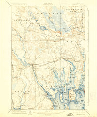
1904 Map of Cherryfield
USGS Topo · Published 1937About this map
The Narraguagus River and Pleasant River dominate this coastal Maine landscape, carving paths through glacial deposits toward the complex shoreline of Harrington Bay and Narraguagus Bay. In the northern interior, the expansive Blueberry Barrens and Pineo Ridge represent a specialized agricultural and geological environment, notably crossed by the U. S. Coast and Geodetic Survey Base Line with its West Base and East Base survey markers.
Find a feature on this map
105 named features on this map. Tap any name to fly to it.
Don’t see what you’re looking for? This feature index may not catch every label — zoom into the map to look around manually.
Map Details
Editions of this 1904 Cherryfield Map
5 editions found
Other maps of this area

1902 · Cherryfield
USGS Topo · 1:62,500

1904 · Cherryfield
USGS Topo · 1:62,500

1904 · Bar Harbor
USGS Topo · 1:62,500

1904 · Petit Manan
USGS Topo · 1:62,500

1921 · Great Wass Island
USGS Topo · 1:62,500

1921 · Columbia Falls
USGS Topo · 1:62,500

1921 · Columbia Falls
USGS Topo · 1:62,500

1929 · Lead Mountain
USGS Topo · 1:48,000

1930 · Tunk Lake
USGS Topo · 1:48,000

1932 · Tunk Lake
USGS Topo · 1:62,500