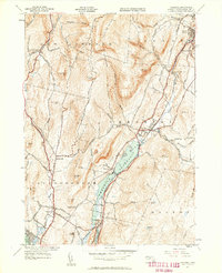
1944 Map of Cheshire
USGS Topo · Published 1958About this map
The Hoosic River corridor serves as the industrial and transportation spine of this region during the mid-1940s, supporting a string of settlements from Adams and Maple Grove in the north down to Berkshire in the south. The Boston and Albany RR follows this valley floor, passing through Cheshire Harbor and Arnoldsville while skirting the eastern edge of the expansive Cheshire Reservoir. This landscape is defined by the steep elevation changes between the valley and high points like Saddle Ball Mountain and North Mountain. High-altitude recreation and resource extraction are both evident, with the Appalachian Trail winding across the ridges while a Quarry and the Stone Sch sit near the base of Pratt Hill. The presence of smaller catchments like Lanesboro Reservoir reflects the localized water management necessary for these hill-country communities.
Find a feature on this map
81 named features on this map. Tap any name to fly to it.
Don’t see what you’re looking for? This feature index may not catch every label — zoom into the map to look around manually.
Map Details
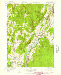
Editions of this 1944 Cheshire Map
2 editions found
Other maps of this area

1886 · Greylock
USGS Topo · 1:62,500

1886 · Becket
USGS Topo · 1:62,500

1888 · Becket
USGS Topo · 1:62,500

1888 · Berlin
USGS Topo · 1:62,500

1888 · Pittsfield
USGS Topo · 1:62,500

1890 · Pittsfield
USGS Topo · 1:62,500

1890 · Berlin
USGS Topo · 1:62,500

1891 · Greylock
USGS Topo · 1:62,500

1893 · Becket
USGS Topo · 1:62,500

1893 · Greylock
USGS Topo · 1:62,500