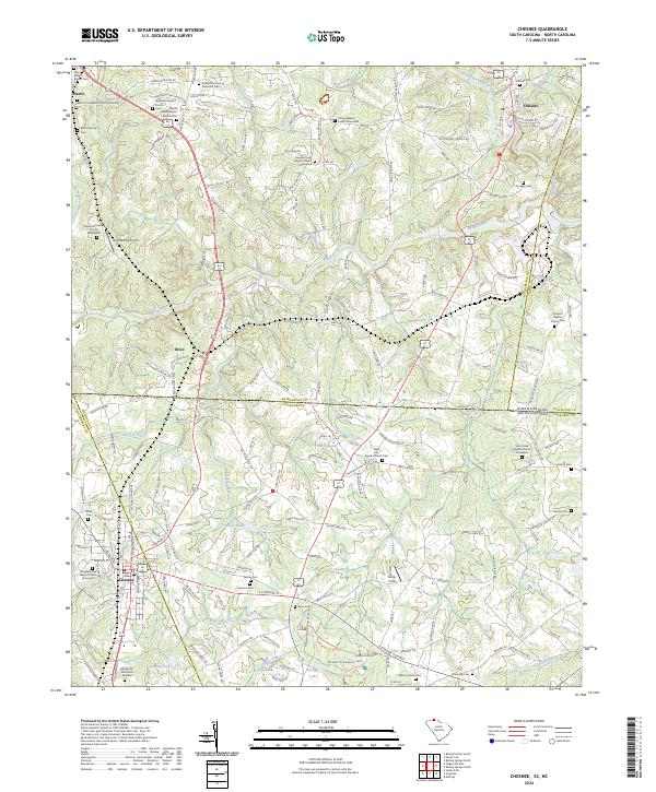
2024 Map of Chesnee
USGS Topo · Published 2024About this map
Cowpens National Battlefield anchors the southern portion of this borderlands map, marking the site of a pivotal Revolutionary War engagement within the rolling terrain of the Carolina Piedmont. The landscape is defined by the winding course of the Broad River, which flows through the center of the sheet alongside its major tributaries, the Second Broad River and Cherokee Creek. The map documents a rural transition zone where the settlements of Chesnee, Brice, and Harris are connected by the Mid-Atlantic RR and US Hwy 221A.
Find a feature on this map
146 named features on this map. Tap any name to fly to it.
Don’t see what you’re looking for? This feature index may not catch every label — zoom into the map to look around manually.
Map Details
Editions of this 2024 Chesnee Map
This is the sole edition of this map. No revisions or reprints were ever made.
Other maps of this area

1909 · Gaffney
USGS Topo · 1:62,500

1950 · Shelby
USGS Topo · 1:62,500

1953 · Charlotte
USGS Topo · 1:250,000

1954 · Charlotte
USGS Topo · 1:250,000

1959 · Cowpens
USGS Topo · 1:62,500

1960 · Charlotte
USGS Topo · 1:250,000

1962 · Charlotte
USGS Topo · 1:250,000

1966 · Forest City
USGS Topo · 1:24,000
1966 · Rutherfordton South
USGS Topo · 1:24,000
1971 · Boiling Springs South
USGS Topo · 1:24,000