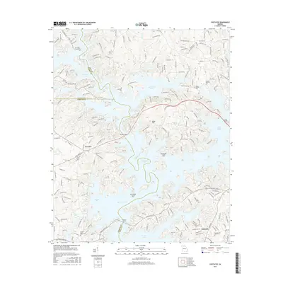
2017 Map of Chestatee
USGS Topo · Published 2017About this map
Lake Sidney Lanier dominates the landscape of this 2017 survey, where the submerged valleys of the Chestatee River and its tributaries form a complex system of coves and peninsulas. The map illustrates the contemporary intersection of recreational water access and residential growth near Chestatee and the northern edge of Oakwood. Significant infrastructure including Bolling Bridge and Browns Bridge provide vital crossings over the sprawling reservoir, connecting Hall, Dawson, and Forsyth counties. Historically grounded sites remain visible amidst the modern road networks of the Jesse Jewell Pkwy and Ga 53, with several local landmarks such as Antioch Methodist Cem and Prospect Cem preserved on the higher ground. The topography around Banks Mtn provides a sharp contrast to the irregular shoreline of Chestatee Bay, reflecting the varied terrain of the Georgia Piedmont.
Find a feature on this map
79 named features on this map. Tap any name to fly to it.
Don’t see what you’re looking for? This feature index may not catch every label — zoom into the map to look around manually.
Map Details
Editions of this 2017 Chestatee Map
This is the sole edition of this map. No revisions or reprints were ever made.
Other maps of this area

1890 · Suwanee
USGS Topo · 1:125,000

1891 · Gainesville
USGS Topo · 1:125,000

1894 · Suwanee
USGS Topo · 1:125,000

1954 · Greenville
USGS Topo · 1:250,000

1955 · Rome
USGS Topo · 1:250,000

1958 · Greenville
USGS Topo · 1:250,000

1958 · Rome
USGS Topo · 1:250,000

1961 · Rome
USGS Topo · 1:250,000

1963 · Rome
USGS Topo · 1:250,000

1964 · Murrayville
USGS Topo · 1:24,000