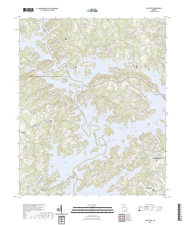
2024 Map of Chestatee
USGS Topo · Published 2024About this map
Lake Sidney Lanier dominates this North Georgia landscape, where the confluence of the Chestatee River and Chattahoochee River creates a complex network of inlets and coves like Chestatee Bay. The map documents a blend of contemporary lakeside development and older rural foundations, marked by traditional river crossings such as Keith Ferry and Shallow Ford. The topographical detail highlights the rise of Banks Mountain alongside numerous creek valleys, including Twomile Creek and Johnson Creek.
Find a feature on this map
253 named features on this map. Tap any name to fly to it.
Don’t see what you’re looking for? This feature index may not catch every label — zoom into the map to look around manually.
Map Details
Editions of this 2024 Chestatee Map
This is the sole edition of this map. No revisions or reprints were ever made.
Other maps of this area

1890 · Suwanee
USGS Topo · 1:125,000

1891 · Gainesville
USGS Topo · 1:125,000

1894 · Suwanee
USGS Topo · 1:125,000

1954 · Greenville
USGS Topo · 1:250,000

1955 · Rome
USGS Topo · 1:250,000

1958 · Greenville
USGS Topo · 1:250,000

1958 · Rome
USGS Topo · 1:250,000

1961 · Rome
USGS Topo · 1:250,000

1963 · Rome
USGS Topo · 1:250,000

1964 · Murrayville
USGS Topo · 1:24,000