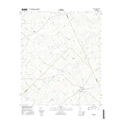
2017 Map of Chester
USGS Topo · Published 2017About this map
The town of Chester serves as a focal point in this landscape where the boundaries of Dodge, Bleckley, and Laurens counties converge. The settlement pattern is defined by a network of rural roads connecting small communities such as Goldsboro, Rebie, and Rowland. The geography is etched with numerous family and community burial grounds, including the Hinson Cem, Mullis-Cole Cem, and Rowland Cem, which offer significant touchpoints for genealogical research in this part of Georgia.
Find a feature on this map
93 named features on this map. Tap any name to fly to it.
Don’t see what you’re looking for? This feature index may not catch every label — zoom into the map to look around manually.
Map Details
Editions of this 2017 Chester Map
This is the sole edition of this map. No revisions or reprints were ever made.
Other maps of this area

1956 · Cochran
USGS Topo · 1:62,500

1956 · Jeffersonville
USGS Topo · 1:62,500

1957 · Macon
USGS Topo · 1:250,000

1958 · Macon
USGS Topo · 1:250,000

1964 · Macon
USGS Topo · 1:250,000

1973 · Cadwell
USGS Topo · 1:24,000

1974 · Chester
USGS Topo · 1:24,000

1974 · Danville East
USGS Topo · 1:24,000

1974 · Dudley
USGS Topo · 1:24,000
1974 · Yonkers
USGS Topo · 1:24,000