
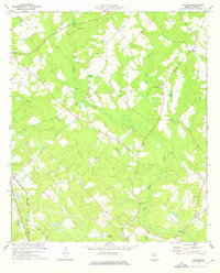
1973 Map of Cadwell
USGS Topo · Published 1976About this map
The agricultural landscape of Cadwell and Plainfield is defined by a network of small family-centered settlements and rural congregations. Traces of past infrastructure are visible in the Old Railroad Grade cutting diagonally through the terrain south of Coleman. This survey records a significant number of rural landmarks, including several churches such as Middle Ground Ch and Reedy Springs Ch, and cemeteries like Bee Hive Cem and Mullis Cem that serve as vital records for local genealogy. The boundary between Dodge Co and Laurens Co meanders through the western portion of the map, following the courses of Batson Creek and Alligator Creek. This era of the early 1970s shows the region's development tied to these small hubs, with Roadside Park serving as a community landmark on the outskirts of Cadwell.
Find a feature on this map
28 named features on this map. Tap any name to fly to it.
Don’t see what you’re looking for? This feature index may not catch every label — zoom into the map to look around manually.
Map Details
Editions of this 1973 Cadwell Map
This is the sole edition of this map. No revisions or reprints were ever made.
Other maps of this area

1957 · Macon
USGS Topo · 1:250,000

1958 · Macon
USGS Topo · 1:250,000

1964 · Macon
USGS Topo · 1:250,000

1972 · Eastman
USGS Topo · 1:24,000

1972 · Mc Rae NW
USGS Topo · 1:24,000

1972 · Jay Bird Springs
USGS Topo · 1:24,000

1974 · Chester
USGS Topo · 1:24,000

1974 · Five Points
USGS Topo · 1:24,000

1974 · Rentz
USGS Topo · 1:24,000
1974 · Yonkers
USGS Topo · 1:24,000