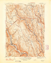
1948 Map of Chester
USGS Topo · Published 1948About this map
The Boston and Albany RR follows the narrow valley of the West Branch Westfield River through the heart of Chester, illustrating the vital rail corridor that shaped these hill towns. This 1948 edition captures a landscape defined by small river-crossing settlements like North Chester and Dayville, and the higher elevation hamlets of Ringville and South Worthington. The map is particularly rich for genealogical research, identifying numerous family-named landmarks and small burial grounds such as the Old Leonard Cem, Wright Cem, and Ireland St Cem. Natural features like Glendale Falls and the surrounding peaks of Gobble Mtn and Abbott Hill emphasize the transition from the river basins to the high ridges of Chesterfield and Worthington. A lone Airway Beacon atop a ridge near Gobble Mtn serves as a reminder of mid-century aviation infrastructure in this upland terrain.
Find a feature on this map
123 named features on this map. Tap any name to fly to it.
Don’t see what you’re looking for? This feature index may not catch every label — zoom into the map to look around manually.
Map Details
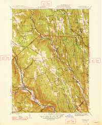
Editions of this 1948 Chester Map
2 editions found
Other maps of this area

1886 · Chesterfield
USGS Topo · 1:62,500

1886 · Becket
USGS Topo · 1:62,500

1887 · Granville
USGS Topo · 1:62,500

1888 · Becket
USGS Topo · 1:62,500

1888 · Sandisfield
USGS Topo · 1:62,500

1888 · Chesterfield
USGS Topo · 1:62,500

1889 · Granville
USGS Topo · 1:62,500

1893 · Granville
USGS Topo · 1:62,500

1893 · Chesterfield
USGS Topo · 1:62,500

1893 · Becket
USGS Topo · 1:62,500