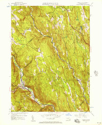
1956 Map of Chester
USGS Topo · Published 1957About this map
The Middle Branch Westfield River carves a deep path through this upland landscape, where the town of Chester and its outlying hamlets are defined by the steep rises of the Berkshires. The Boston and Albany railroad follows the river's winding course, serving as the primary transportation artery for the region. To the south, the Chester Blandford State Forest occupies the higher elevations, while the hillsides are dotted with legacy family names on roads like Arthur Pease Road and Sylvester Hamilton Rd.
Find a feature on this map
109 named features on this map. Tap any name to fly to it.
Don’t see what you’re looking for? This feature index may not catch every label — zoom into the map to look around manually.
Map Details
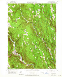
Editions of this 1956 Chester Map
2 editions found
Other maps of this area

1886 · Chesterfield
USGS Topo · 1:62,500

1886 · Becket
USGS Topo · 1:62,500

1887 · Granville
USGS Topo · 1:62,500

1888 · Becket
USGS Topo · 1:62,500

1888 · Sandisfield
USGS Topo · 1:62,500

1888 · Chesterfield
USGS Topo · 1:62,500

1889 · Granville
USGS Topo · 1:62,500

1893 · Granville
USGS Topo · 1:62,500

1893 · Chesterfield
USGS Topo · 1:62,500

1893 · Becket
USGS Topo · 1:62,500