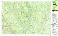
1987 Map of Chester
USGS Topo · Published 1987About this map
The Middle Branch Westfield River and the main Westfield River channel carve through the central highlands of Hampshire and Hampden Counties, defining the industrial and topographical character of this 1980s landscape. Engineering projects of the mid-20th century are prominent, including the Knightville Dam and the Littleville Dam, which created substantial reservoirs like Knightville Lake and Littleville Lake. These waters replaced older valley floor footprints, though many family burial grounds such as Old Leonard Cem, Bofat Cem, and Norwich Bridge Cem remain as markers of the area's earlier agricultural settlements.
Find a feature on this map
126 named features on this map. Tap any name to fly to it.
Don’t see what you’re looking for? This feature index may not catch every label — zoom into the map to look around manually.
Map Details
Editions of this 1987 Chester Map
2 editions found
Other maps of this area

1885 · Northampton
USGS Topo · 1:62,500

1886 · Springfield
USGS Topo · 1:62,500

1886 · Chesterfield
USGS Topo · 1:62,500

1886 · Northampton
USGS Topo · 1:62,500

1886 · Becket
USGS Topo · 1:62,500

1887 · Granville
USGS Topo · 1:62,500

1888 · Becket
USGS Topo · 1:62,500

1888 · Sandisfield
USGS Topo · 1:62,500

1888 · Chesterfield
USGS Topo · 1:62,500

1889 · Springfield
USGS Topo · 1:62,500