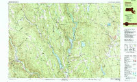
1987 Map of Chester
USGS Topo · Published 1987About this map
The Westfield River and its multiple branches carve through this portion of the Berkshires, dictating the settlement patterns and industrial infrastructure of the late 20th century. Major civil engineering projects such as the Littleville Dam and Knightville Dam have transformed the valley floor into significant reservoirs like Littleville Lake and Knightville Lake, while much of the surrounding upland is preserved within the Hiram H Fox State Wildlife Management Area and Chester-Blandford State Forest.
Find a feature on this map
142 named features on this map. Tap any name to fly to it.
Don’t see what you’re looking for? This feature index may not catch every label — zoom into the map to look around manually.
Map Details
Editions of this 1987 Chester Map
2 editions found
Other maps of this area

1885 · Northampton
USGS Topo · 1:62,500

1886 · Springfield
USGS Topo · 1:62,500

1886 · Chesterfield
USGS Topo · 1:62,500

1886 · Northampton
USGS Topo · 1:62,500

1886 · Becket
USGS Topo · 1:62,500

1887 · Granville
USGS Topo · 1:62,500

1888 · Becket
USGS Topo · 1:62,500

1888 · Sandisfield
USGS Topo · 1:62,500

1888 · Chesterfield
USGS Topo · 1:62,500

1889 · Springfield
USGS Topo · 1:62,500