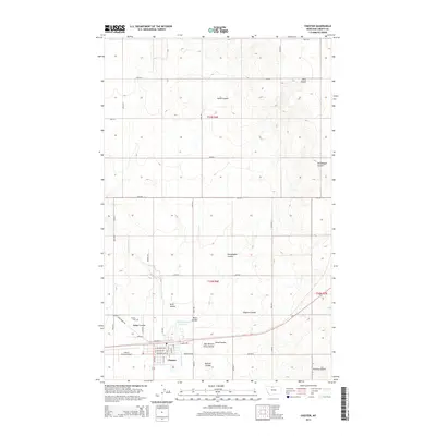
2014 Map of Chester
USGS Topo · Published 2014About this map
Chester serves as the primary hub of activity in this northern Montana landscape, situated along the Great Northern RR and Us-2. The town's grid is well-defined by streets such as W Madison Ave and Main St, with the Liberty County Airport located just to the west. Outside the settlement, the terrain is shaped by an extensive network of dry washes and water features, including the Great Northern Reservoir and the winding path of Cottonwood Cr. Numerous named coulees, such as Alma Coulee, Keith Coulee, and Heimbigner Coulee, illustrate the drainage patterns typical of the region. Local history is anchored by landmarks like the Chester Cem and an established township system including t32n r6e and t33n r6e, which organize the surrounding agricultural and ranching lands during this early 21st-century period.
Find a feature on this map
84 named features on this map. Tap any name to fly to it.
Don’t see what you’re looking for? This feature index may not catch every label — zoom into the map to look around manually.
Map Details
Editions of this 2014 Chester Map
This is the sole edition of this map. No revisions or reprints were ever made.
Other maps of this area

1919 · Alma
USGS Topo · 1:125,000

1954 · Shelby
USGS Topo · 1:250,000

1958 · Shelby
USGS Topo · 1:250,000

1962 · Tiber
USGS Topo · 1:24,000

1962 · Lakey Ranch
USGS Topo · 1:24,000

1963 · Joplin
USGS Topo · 1:24,000

1963 · Chester NW
USGS Topo · 1:24,000

1963 · Chester NE
USGS Topo · 1:24,000

1963 · Chester
USGS Topo · 1:24,000

1970 · Poverty Coulee NE
USGS Topo · 1:24,000