
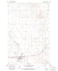
1963 Map of Chester
USGS Topo · Published 1966About this map
Chester serves as the focal point of this northern Montana landscape, situated at the junction of the Great Northern railroad and regional transport lines. The 1963 survey captures the town's essential infrastructure, including the Liberty County Airport and a dedicated Athletic Field. To the north, the terrain is marked by the winding course of Cottonwood Creek and several Gravel Pits, indicating the local industry and geology of the era. The presence of the Great Northern Reservoir and a nearby Filtration Plant highlights the managed water systems necessary for this high-plains community. On the western outskirts, the Chester Cemetery remains a key landmark for genealogical research, while a significant Pipeline cuts across the northern sections, reflecting mid-century energy development in the region.
Find a feature on this map
13 named features on this map. Tap any name to fly to it.
Don’t see what you’re looking for? This feature index may not catch every label — zoom into the map to look around manually.
Map Details
Editions of this 1963 Chester Map
2 editions found
Other maps of this area

1919 · Alma
USGS Topo · 1:125,000

1954 · Shelby
USGS Topo · 1:250,000

1958 · Shelby
USGS Topo · 1:250,000

1962 · Tiber
USGS Topo · 1:24,000

1962 · Lakey Ranch
USGS Topo · 1:24,000

1963 · Joplin
USGS Topo · 1:24,000

1963 · Chester NW
USGS Topo · 1:24,000

1963 · Chester NE
USGS Topo · 1:24,000

1970 · Poverty Coulee NE
USGS Topo · 1:24,000

1970 · Sagebrush Coulee
USGS Topo · 1:24,000