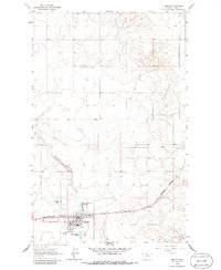
1963 Map of Chester
USGS Topo · Published 1986About this map
Chester serves as the focal point of this Liberty County landscape, situated along the tracks of the Burlington Northern railroad. In the early 1960s, the town's infrastructure supported a growing agricultural and transportation hub, evidenced by the Liberty County Airport and a dedicated Filtration Plant. The presence of the Great Northern Reservoir and a Sewage Disposal Pond suggests the organized water management required for this high plains settlement. To the west, Cottonwood Creek meanders through the terrain, flanked by several Gravel Pits that likely provided materials for local road and rail construction. The map also records the community's local life through the Athletic Field and the Chester Cemetery on the outskirts of town, while a major Pipeline cuts across the northern prairie, highlighting the region's role in energy transit.
Find a feature on this map
13 named features on this map. Tap any name to fly to it.
Don’t see what you’re looking for? This feature index may not catch every label — zoom into the map to look around manually.
Map Details
Editions of this 1963 Chester Map
2 editions found
Other maps of this area

1919 · Alma
USGS Topo · 1:125,000

1954 · Shelby
USGS Topo · 1:250,000

1958 · Shelby
USGS Topo · 1:250,000

1962 · Tiber
USGS Topo · 1:24,000

1962 · Lakey Ranch
USGS Topo · 1:24,000

1963 · Joplin
USGS Topo · 1:24,000

1963 · Chester NW
USGS Topo · 1:24,000

1963 · Chester NE
USGS Topo · 1:24,000

1963 · Chester
USGS Topo · 1:24,000

1970 · Poverty Coulee NE
USGS Topo · 1:24,000