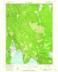
1956 Map of Chester
USGS Topo · Published 1961About this map
The timber and transit hub of Westwood anchors the southeastern corner of this map, showcasing its intersection with the Pacific Western Railroad and proximity to the Mtn Meadows Res. The landscape transitions from the developed community of Chester and the recreational shoreline of Lake Almanor to the managed wilderness of the Swain Mountain Experimental Forest. Between these points, the map documents smaller outposts such as Heckle Ranch and Benner, alongside local educational infrastructure like the Fletcher-Walker School.
Find a feature on this map
83 named features on this map. Tap any name to fly to it.
Don’t see what you’re looking for? This feature index may not catch every label — zoom into the map to look around manually.
Map Details
Editions of this 1956 Chester Map
4 editions found

Other maps of this area

1886 · Honey Lake
USGS Topo · 1:250,000

1886 · Lassen Peak
USGS Topo · 1:250,000

1891 · Honey Lake
USGS Topo · 1:250,000

1892 · Lassen Peak
USGS Topo · 1:250,000

1893 · Honey Lake
USGS Topo · 1:250,000

1894 · Lassen Peak
USGS Topo · 1:250,000

1939 · Halls Flat
USGS Topo · 1:125,000

1950 · Greenville
USGS Topo · 1:62,500

1955 · Westwood
USGS Topo · 1:62,500

1955 · Almanor
USGS Topo · 1:62,500