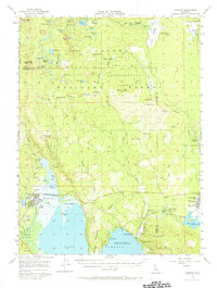
1956 Map of Chester
USGS Topo · Published 1971About this map
The northern reaches of Lake Almanor and the industrial layout of Westwood anchor this mid-century survey of the Plumas and Lassen county line. The settlement of Chester is shown in detail, adjacent to the Chester Airport and the Lake Almanor Country Club. To the east, the timber and rail legacy of Westwood is evident in the proximity of the Western Pacific railroad lines and local education landmarks like the Fletcher-Walker School and the High School.
Find a feature on this map
79 named features on this map. Tap any name to fly to it.
Don’t see what you’re looking for? This feature index may not catch every label — zoom into the map to look around manually.
Map Details
Editions of this 1956 Chester Map
4 editions found

Other maps of this area

1886 · Honey Lake
USGS Topo · 1:250,000

1886 · Lassen Peak
USGS Topo · 1:250,000

1891 · Honey Lake
USGS Topo · 1:250,000

1892 · Lassen Peak
USGS Topo · 1:250,000

1893 · Honey Lake
USGS Topo · 1:250,000

1894 · Lassen Peak
USGS Topo · 1:250,000

1939 · Halls Flat
USGS Topo · 1:125,000

1950 · Greenville
USGS Topo · 1:62,500

1955 · Westwood
USGS Topo · 1:62,500

1955 · Almanor
USGS Topo · 1:62,500