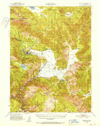
1950 Map of Greenville
USGS Topo · Published 1952About this map
Indian Valley serves as the focal point of this mid-century survey, where the Western Pacific RR snakes along the canyon walls of Indian Creek. The area’s complex industrial and social history is visible through the concentration of mining operations and tribal lands, including the Greenville Rancheria and Taylorsville Rancheria. Mining activity is particularly dense in the northern and southern ridges, where the Engel Mine, Ruby Mine, and King Solomon Mine reflect a century of extraction.
Find a feature on this map
89 named features on this map. Tap any name to fly to it.
Don’t see what you’re looking for? This feature index may not catch every label — zoom into the map to look around manually.
Map Details
Editions of this 1950 Greenville Map
4 editions found
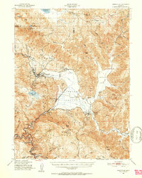
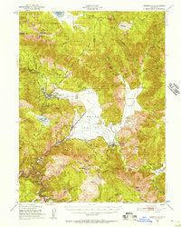
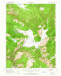
Other maps of this area

1886 · Honey Lake
USGS Topo · 1:250,000

1886 · Lassen Peak
USGS Topo · 1:250,000

1888 · Bidwell Bar
USGS Topo · 1:125,000

1891 · Bidwell Bar
USGS Topo · 1:125,000

1891 · Downieville
USGS Topo · 1:125,000

1891 · Honey Lake
USGS Topo · 1:250,000

1892 · Lassen Peak
USGS Topo · 1:250,000

1893 · Bidwell Bar
USGS Topo · 1:125,000

1893 · Honey Lake
USGS Topo · 1:250,000

1893 · Downieville
USGS Topo · 1:125,000