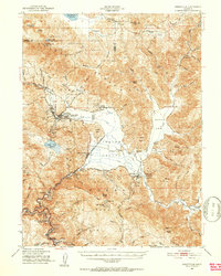
1950 Map of Greenville
USGS Topo · Published 1952About this map
Indian Valley serves as the central hub of this mid-century Plumas County survey, where agricultural land and ranching settlements like Strong Ranch and Crescent Mills meet the timbered slopes of the Plumas National Forest. The map documents a significant cultural landscape, including the Greenville Rancheria, Taylorsville Rancheria, and the Indian Mission near Greenville. These sites reflect the enduring presence of local Indigenous communities alongside the industrial development of the era.
Find a feature on this map
68 named features on this map. Tap any name to fly to it.
Don’t see what you’re looking for? This feature index may not catch every label — zoom into the map to look around manually.
Map Details
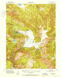
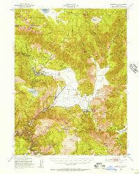
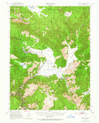
Editions of this 1950 Greenville Map
4 editions found
Other maps of this area

1886 · Honey Lake
USGS Topo · 1:250,000

1886 · Lassen Peak
USGS Topo · 1:250,000

1888 · Bidwell Bar
USGS Topo · 1:125,000

1891 · Bidwell Bar
USGS Topo · 1:125,000

1891 · Downieville
USGS Topo · 1:125,000

1891 · Honey Lake
USGS Topo · 1:250,000

1892 · Lassen Peak
USGS Topo · 1:250,000

1893 · Bidwell Bar
USGS Topo · 1:125,000

1893 · Honey Lake
USGS Topo · 1:250,000

1893 · Downieville
USGS Topo · 1:125,000