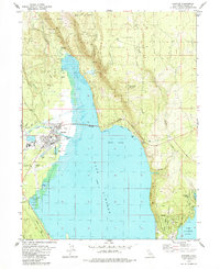
1979 Map of Chester
USGS Topo · Published 1984About this map
Chester serves as the primary hub at the northwestern edge of Lake Almanor in this late 1970s record of Plumas County. The map details the transition from the developed townsite—complete with its High School, Chester Airport, and extensive Sewage Disposal Ponds—to the surrounding timberlands of the Lassen National Forest. Local infrastructure like the Almanor Ranger Station and various gravel pits highlight the intersection of government land management and local industry.
Find a feature on this map
40 named features on this map. Tap any name to fly to it.
Don’t see what you’re looking for? This feature index may not catch every label — zoom into the map to look around manually.
Map Details
Editions of this 1979 Chester Map
4 editions found
Other maps of this area

1886 · Lassen Peak
USGS Topo · 1:250,000

1892 · Lassen Peak
USGS Topo · 1:250,000

1894 · Lassen Peak
USGS Topo · 1:250,000

1955 · Almanor
USGS Topo · 1:62,500

1955 · Westwood
USGS Topo · 1:250,000

1956 · Mt. Harkness
USGS Topo · 1:62,500

1956 · Chester
USGS Topo · 1:62,500

1958 · Westwood
USGS Topo · 1:250,000

1958 · Jonesville
USGS Topo · 1:62,500

1959 · Westwood
USGS Topo · 1:250,000