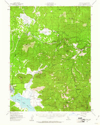
1959 Map of Westwood
USGS Topo · Published 1959About this map
Susanville sits at the heart of this mid-century Northeastern California landscape, where the Sierra Nevada and Cascade ranges meet the high desert of the Madeline Plains. The geography is defined by significant water bodies, including the massive Honey Lake and Eagle Lake, alongside man-made landmarks like the Sierra Ordinance Depot near Herlong. This survey illustrates the intricate timber and rail economy of the 1950s, with the Southern Pacific and Western Pacific railroads threading through the mountains to serve valley settlements like Janesville and Standish. Volcanic features are prominent, ranging from the heights of Lassen Peak to the isolated Hayden Hill. The map also captures the early recreational footprint around Lake Almanor and the North Fork Feather River, providing a detailed record of the region's transition from a remote frontier to a managed resource landscape.
Find a feature on this map
136 named features on this map. Tap any name to fly to it.
Don’t see what you’re looking for? This feature index may not catch every label — zoom into the map to look around manually.
Map Details
Editions of this 1959 Westwood Map
This is the sole edition of this map. No revisions or reprints were ever made.
Historical Maps of Susanville Through Time
4 maps found