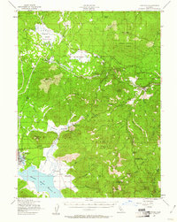
1958 Map of Westwood
USGS Topo · Published 1958About this map
Lassen Peak and the surrounding volcanic landscape dominate the western reach of this survey, where the Lassen Volcanic National Park meets several large timber-rich national forests. The 1950s infrastructure is clearly defined, showing the expansion of water management systems like Lake Almanor, Butt Valley Reservoir, and the McCoy Flat Reservoir. These reservoirs, along with the Susan River, supported the growing population centers of Susanville and Burney. In the east, the terrain transitions into the high desert basins of Dixie Valley and the vast alkali flats surrounding Honey Lake. The era’s military presence is notable at the Sierra Ordinance Depot near Herlong, a significant industrial and logistics hub for the region during the Cold War. Transportation networks, including the Southern Pacific railroad and early mountain highways like Route 36, connect these isolated mountain outposts and ranger stations.
Find a feature on this map
114 named features on this map. Tap any name to fly to it.
Don’t see what you’re looking for? This feature index may not catch every label — zoom into the map to look around manually.
Map Details
Editions of this 1958 Westwood Map
This is the sole edition of this map. No revisions or reprints were ever made.
Historical Maps of Susanville Through Time
4 maps found