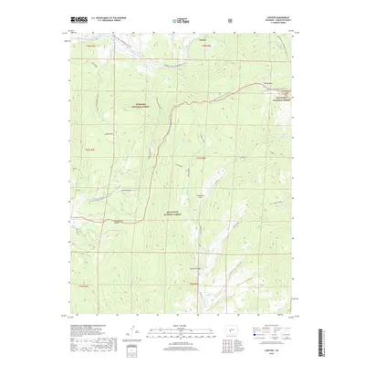
2019 Map of Chester
USGS Topo · Published 2019About this map
Chester sits at the northern edge of this high-altitude landscape, where the boundaries of three major western forests converge. The Continental Divide bisects the terrain, serving as the physical spine between the Gunnison National Forest, San Isabel National Forest, and Rio Grande National Forest. This 2019 survey documents a region defined by its hydrography and trail systems rather than dense settlement, highlighting the Continental Divide National Scenic Trail as it snakes through the Cochetopa Hills.
Find a feature on this map
77 named features on this map. Tap any name to fly to it.
Don’t see what you’re looking for? This feature index may not catch every label — zoom into the map to look around manually.
Map Details
Editions of this 2019 Chester Map
This is the sole edition of this map. No revisions or reprints were ever made.
Other maps of this area

1956 · Montrose
USGS Topo · 1:250,000

1959 · Montrose
USGS Topo · 1:250,000

1959 · Bonanza
USGS Topo · 1:62,500

1960 · Montrose
USGS Topo · 1:250,000

1964 · Sargents
USGS Topo · 1:24,000

1967 · Sargents Mesa
USGS Topo · 1:24,000

1967 · Trickle Mountain
USGS Topo · 1:24,000

1967 · Lake Mountain NE
USGS Topo · 1:24,000

1967 · Chester
USGS Topo · 1:24,000

1967 · Pahlone Peak
USGS Topo · 1:24,000