
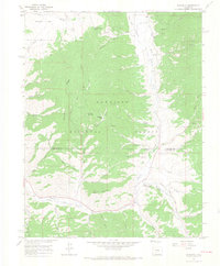
1964 Map of Sargents
USGS Topo · Published 1967About this map
Sargents sits at the junction of several high-altitude drainages within the Gunnison National Forest, serving as a focal point for transportation and early ranching along the Tomichi Creek corridor. The landscape is defined by the legacy of mountain transit, particularly the Marshall Pass Railroad Grade and another Old Railroad Grade that snake along the valley floor near Steepy Mountain. These routes trace the historical path of the Denver & Rio Grande Western through the Rockies, crossing the Gunnison and Saguache county line. Local landmarks like Waunita Park, Black Sage Pass, and Quakey Mountain provide a glimpse into the naming conventions of early settlers and ranchers. High-country water sources such as Agate Creek and Spring Creek feed into the main valley, where a Gaging Station and a lone Grave reflect the intersection of government land management and personal history in this high-desert mountain terrain.
Find a feature on this map
49 named features on this map. Tap any name to fly to it.
Don’t see what you’re looking for? This feature index may not catch every label — zoom into the map to look around manually.
Map Details
Editions of this 1964 Sargents Map
4 editions found
Other maps of this area

1940 · Garfield
USGS Topo · 1:62,500

1941 · Pitkin
USGS Topo · 1:62,500

1945 · Pitkin
USGS Topo · 1:62,500

1945 · Garfield
USGS Topo · 1:62,500

1956 · Montrose
USGS Topo · 1:250,000

1959 · Montrose
USGS Topo · 1:250,000

1960 · Montrose
USGS Topo · 1:250,000

1962 · Doyleville
USGS Topo · 1:24,000

1962 · West Baldy
USGS Topo · 1:24,000
1964 · Pitkin
USGS Topo · 1:24,000