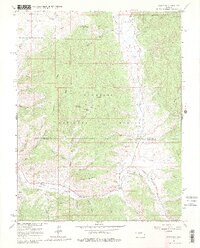
1964 Map of Sargents
USGS Topo · Published 1980About this map
Sargents sits at the southern edge of this mid-century topographic study, serving as a focal point where the Old Railroad Grade meets the waters of Tomichi Creek. The landscape transitions from the high peaks of Steepy Mountain and Quakey Mountain into the valley floors of Waunita Park and Dawson Park. This area of the Gunnison National Forest is defined by its complex drainage systems, including Agate Creek and Porphyry Creek, which feed into the larger creek systems that shaped early transport routes. A solitary Grave at Black Sage Pass and scattered Prospect sites hint at the early human presence and mineral exploration common to this high-altitude terrain. The presence of a Gaging Sta and an Indefinite Boundary between Gunnison and Saguache counties underscores the logistical challenges of surveying this mountain environment in the 1960s.
Find a feature on this map
47 named features on this map. Tap any name to fly to it.
Don’t see what you’re looking for? This feature index may not catch every label — zoom into the map to look around manually.
Map Details
Editions of this 1964 Sargents Map
4 editions found

Other maps of this area

1940 · Garfield
USGS Topo · 1:62,500

1941 · Pitkin
USGS Topo · 1:62,500

1945 · Pitkin
USGS Topo · 1:62,500

1945 · Garfield
USGS Topo · 1:62,500

1956 · Montrose
USGS Topo · 1:250,000

1959 · Montrose
USGS Topo · 1:250,000

1960 · Montrose
USGS Topo · 1:250,000

1962 · Doyleville
USGS Topo · 1:24,000

1962 · West Baldy
USGS Topo · 1:24,000
1964 · Pitkin
USGS Topo · 1:24,000