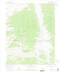
1964 Map of Sargents
USGS Topo · Published 1980About this map
Sargents sits at the base of the high country where the Old Railroad Grade follows the curve of Tomichi Creek. This mid-1960s landscape is defined by its industrial and transit history, featuring an old logging or milling site at Sawmill and numerous extraction markers like the Gravel Pit near Black Sage Pass. The terrain is a complex network of drainages and high points, including Quakey Mountain Ridge and Means Mountain, which overlook a series of gulches and parks. Evidence of early settlement and travel is visible through the scattered Prospect sites and the lone Grave south of the creek. Much of the northern and central portion is managed as the Gunnison National Forest, where the transition from deep gulches like Deadman Gulch to open areas like Dawson Park reflects the high-altitude topography of the Gunnison and Saguache County line.
Find a feature on this map
51 named features on this map. Tap any name to fly to it.
Don’t see what you’re looking for? This feature index may not catch every label — zoom into the map to look around manually.
Map Details
Editions of this 1964 Sargents Map
4 editions found

Other maps of this area

1940 · Garfield
USGS Topo · 1:62,500

1941 · Pitkin
USGS Topo · 1:62,500

1945 · Pitkin
USGS Topo · 1:62,500

1945 · Garfield
USGS Topo · 1:62,500

1956 · Montrose
USGS Topo · 1:250,000

1959 · Montrose
USGS Topo · 1:250,000

1960 · Montrose
USGS Topo · 1:250,000

1962 · Doyleville
USGS Topo · 1:24,000

1962 · West Baldy
USGS Topo · 1:24,000
1964 · Pitkin
USGS Topo · 1:24,000