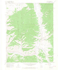
1964 Map of Sargents
USGS Topo · Published 1967About this map
Sargents serves as the focal point of this high-country landscape, positioned along the banks of Tomichi Creek where the valley floor meets the rising peaks of the Gunnison National Forest. The geography here is defined by an intricate network of drainage systems, including Agate Creek and Long Branch, which carve through the terrain beneath Quakey Mountain and Steepy Mountain. An interpretive glance at the transportation markers reveals the area's transition away from early industrial infrastructure; an Old Railroad Grade and numerous segments of Pack Trail suggest a region that was once more heavily reliant on rail and horse-path commerce. To the northwest, Waunita Park and its associated Waunita Spring provide a distinct contrast to the rugged gulches and the high-elevation passage at Black Sage Pass.
Find a feature on this map
46 named features on this map. Tap any name to fly to it.
Don’t see what you’re looking for? This feature index may not catch every label — zoom into the map to look around manually.
Map Details
Editions of this 1964 Sargents Map
4 editions found

Other maps of this area

1940 · Garfield
USGS Topo · 1:62,500

1941 · Pitkin
USGS Topo · 1:62,500

1945 · Pitkin
USGS Topo · 1:62,500

1945 · Garfield
USGS Topo · 1:62,500

1956 · Montrose
USGS Topo · 1:250,000

1959 · Montrose
USGS Topo · 1:250,000

1960 · Montrose
USGS Topo · 1:250,000

1962 · Doyleville
USGS Topo · 1:24,000

1962 · West Baldy
USGS Topo · 1:24,000
1964 · Pitkin
USGS Topo · 1:24,000