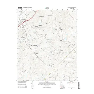
2014 Map of Chestnut Mountain
USGS Topo · Published 2014About this map
Gainesville anchors the northern reaches of this Hall and Jackson County landscape, where the foothills of the Blue Ridge give way to an intricate network of creeks and small communities. The map documents the dense suburban expansion between Oakwood and the eponymous Chestnut Mountain, a region characterized by family-named landmarks and historic congregation sites like Poplar Springs Church. The topography is defined by the Mulberry River and several prominent rises, including Kennedy Mtn and Price Mtn, which overlook a patchwork of older settlements such as Chicopee and Klondike. Genealogists will find a wealth of burial grounds throughout the area, from Redwine Cem in the north to the Macedonia Cem near the southern border, recording the deep-rooted family histories along the historic corridors of the Atlanta Hwy and Winder Hwy.
Find a feature on this map
63 named features on this map. Tap any name to fly to it.
Don’t see what you’re looking for? This feature index may not catch every label — zoom into the map to look around manually.
Map Details
Editions of this 2014 Chestnut Mountain Map
This is the sole edition of this map. No revisions or reprints were ever made.
Other maps of this area

1891 · Gainesville
USGS Topo · 1:125,000

1954 · Greenville
USGS Topo · 1:250,000

1958 · Greenville
USGS Topo · 1:250,000

1964 · Hog Mountain
USGS Topo · 1:24,000

1964 · Chestnut Mountain
USGS Topo · 1:24,000
1964 · Winder North
USGS Topo · 1:24,000
1964 · Auburn
USGS Topo · 1:24,000

1964 · Gainesville
USGS Topo · 1:24,000
1964 · Chestatee
USGS Topo · 1:24,000

1964 · Pendergrass
USGS Topo · 1:24,000