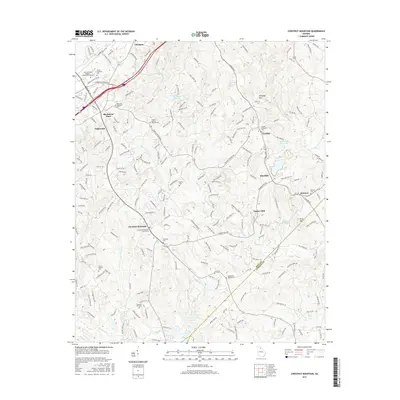
2017 Map of Chestnut Mountain
USGS Topo · Published 2017About this map
Chestnut Mountain serves as a central hub in this Hall County landscape, where the rural past meets the expanding infrastructure of northern Georgia. The map is particularly dense with community markers for genealogists, including numerous well-placed burial grounds such as Union Baptist Cem, Pleasant Hill Cem, and Macedonia Baptist Cem. Education and industry are represented by the Univ of North Georgia - Gainesville Campus and Lanier Technical Coll in the north, while the southern reaches follow the winding path of the Mulberry River. The transition from old crossroads like Klondike and Tanner Mill to modern corridors like Interstate 985 illustrates the area's development. Local topography is defined by prominent rises like Kennedy Mtn and Price Mtn, while water features like Gainesville Stone Lake and McEver Lake dot the rolling hills of the Lott Cr and Walnut Cr drainage basins.
Find a feature on this map
54 named features on this map. Tap any name to fly to it.
Don’t see what you’re looking for? This feature index may not catch every label — zoom into the map to look around manually.
Map Details
Editions of this 2017 Chestnut Mountain Map
This is the sole edition of this map. No revisions or reprints were ever made.
Other maps of this area

1891 · Gainesville
USGS Topo · 1:125,000

1954 · Greenville
USGS Topo · 1:250,000

1958 · Greenville
USGS Topo · 1:250,000

1964 · Hog Mountain
USGS Topo · 1:24,000

1964 · Chestnut Mountain
USGS Topo · 1:24,000
1964 · Winder North
USGS Topo · 1:24,000
1964 · Auburn
USGS Topo · 1:24,000

1964 · Gainesville
USGS Topo · 1:24,000
1964 · Chestatee
USGS Topo · 1:24,000

1964 · Pendergrass
USGS Topo · 1:24,000