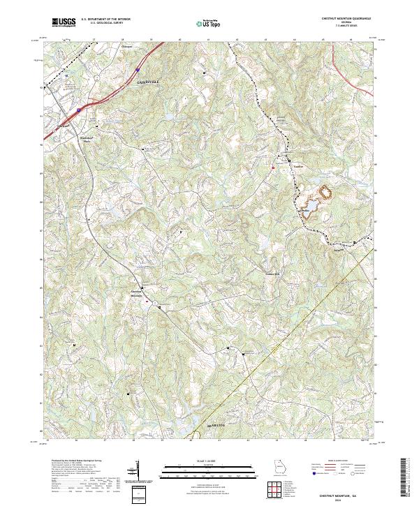
2024 Map of Chestnut Mountain
USGS Topo · Published 2024About this map
Chestnut Mountain and the rolling uplands between the Mulberry River and Walnut Creek define this section of Georgia's Piedmont. The landscape is characterized by a dense network of family and community landmarks, particularly evident in the numerous burial grounds like the Chestnut Mountain Church Cem and Macedonia Baptist Cem. The northern portion of the map is dominated by the urban expansion of Gainesville and Oakwood, including the University of North Georgia - Gainesville Campus and industrial corridors along the Norfolk Southern railway line.
Find a feature on this map
248 named features on this map. Tap any name to fly to it.
Don’t see what you’re looking for? This feature index may not catch every label — zoom into the map to look around manually.
Map Details
Editions of this 2024 Chestnut Mountain Map
This is the sole edition of this map. No revisions or reprints were ever made.
Other maps of this area

1891 · Gainesville
USGS Topo · 1:125,000

1954 · Greenville
USGS Topo · 1:250,000

1958 · Greenville
USGS Topo · 1:250,000

1964 · Hog Mountain
USGS Topo · 1:24,000

1964 · Chestnut Mountain
USGS Topo · 1:24,000
1964 · Winder North
USGS Topo · 1:24,000
1964 · Auburn
USGS Topo · 1:24,000

1964 · Gainesville
USGS Topo · 1:24,000
1964 · Chestatee
USGS Topo · 1:24,000

1964 · Pendergrass
USGS Topo · 1:24,000