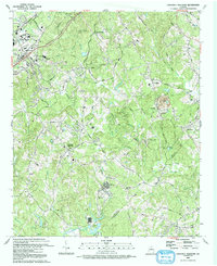
1992 Map of Chestnut Mountain
USGS Topo · Published 1993About this map
The hills of Hall County and Jackson County converge near Chestnut Mountain in this early 1990s survey, showing a landscape of burgeoning institutions and motorsports heritage. The northern reach is anchored by educational and industrial hubs including Gainesville College, Lanier Tech Inst, and the Chicopee Woods Agricultural Center. Transit and trade are defined by the Southern Railway corridor and a network of rural routes like Sloan Mill Road and Ponderosa Farm Road.
Find a feature on this map
70 named features on this map. Tap any name to fly to it.
Don’t see what you’re looking for? This feature index may not catch every label — zoom into the map to look around manually.
Map Details
Editions of this 1992 Chestnut Mountain Map
This is the sole edition of this map. No revisions or reprints were ever made.
Other maps of this area

1891 · Gainesville
USGS Topo · 1:125,000

1954 · Greenville
USGS Topo · 1:250,000

1958 · Greenville
USGS Topo · 1:250,000

1964 · Hog Mountain
USGS Topo · 1:24,000

1964 · Chestnut Mountain
USGS Topo · 1:24,000
1964 · Winder North
USGS Topo · 1:24,000
1964 · Auburn
USGS Topo · 1:24,000

1964 · Gainesville
USGS Topo · 1:24,000
1964 · Chestatee
USGS Topo · 1:24,000

1964 · Pendergrass
USGS Topo · 1:24,000