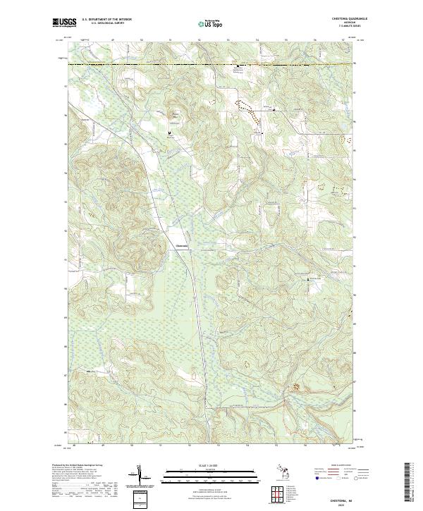
2023 Map of Chestonia
USGS Topo · Published 2023About this map
The Jordan River flows through the heart of this Antrim County landscape, where the small community of Chestonia sits at a crossroads near the river's winding path. This modern survey reflects a region defined by its complex network of waterways, including Sutton Creek, Scott Creek, and the Intermediate River. The terrain is punctuated by the prominence of Mount Bliss, a local landmark surrounded by a series of cemeteries that speak to the area’s long-standing settlement history. Family and community heritage are anchored by sites such as the Saint Johns Nepomucene Pioneer Cem, Settlement Cem, and Trojanek Cem. These burial grounds, alongside the Mount Bliss Cem and Rock Elm Cem, provide vital spatial data for those researching the genealogy and social geography of this rural Michigan township. The map also delineates modern access via M-32 and Co HWY 624, alongside numerous forest trails like the Wildwood Trl and Rolling Thunder Trl.
Find a feature on this map
64 named features on this map. Tap any name to fly to it.
Don’t see what you’re looking for? This feature index may not catch every label — zoom into the map to look around manually.
Map Details
Editions of this 2023 Chestonia Map
This is the sole edition of this map. No revisions or reprints were ever made.
Other maps of this area

1954 · Traverse City
USGS Topo · 1:250,000

1955 · Cheboygan
USGS Topo · 1:250,000

1956 · Alba
USGS Topo · 1:62,500

1956 · Mancelona
USGS Topo · 1:62,500

1958 · Cheboygan
USGS Topo · 1:250,000

1958 · Traverse City
USGS Topo · 1:250,000

1961 · Boyne Falls
USGS Topo · 1:62,500

1961 · Boyne City
USGS Topo · 1:62,500

1975 · Mancelona NE
USGS Topo · 1:24,000

1975 · Mancelona NW
USGS Topo · 1:24,000