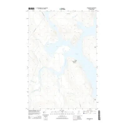
2014 Map of Chesuncook
USGS Topo · Published 2014About this map
The isolated settlement of Chesuncook sits on a narrow peninsula between Chesuncook Lake and the West Branch Penobscot River, reflecting its historic role as a hub for the northern Maine timber industry. This 2014 survey captures the community’s layout, including the Chesuncook Village Cem and Graveyard Point, which offer tangible links for genealogists tracing the families of early river drivers and foresters. The landscape is dominated by water, from the broad reach of the lake containing Gero Island to the intricate network of streams like Little Ragmuff Stream and Brandy Brook. Roads such as the Black Pond Winter Rd and Brandy Brook Rd trace the paths of traditional logging routes, leading into the dense woods surrounding Black Pond and Brandy Pond.
Find a feature on this map
19 named features on this map. Tap any name to fly to it.
Don’t see what you’re looking for? This feature index may not catch every label — zoom into the map to look around manually.
Map Details
Editions of this 2014 Chesuncook Map
This is the sole edition of this map. No revisions or reprints were ever made.
Other maps of this area

1954 · Chesuncook
USGS Topo · 1:62,500

1954 · North East Carry
USGS Topo · 1:62,500

1954 · Caucomgomoc Lake
USGS Topo · 1:62,500

1954 · Grant Farm
USGS Topo · 1:62,500

1954 · Presque Isle
USGS Topo · 1:250,000

1954 · Millinocket
USGS Topo · 1:250,000

1958 · Presque Isle
USGS Topo · 1:250,000

1958 · Millinocket
USGS Topo · 1:250,000

1958 · Chesuncook
USGS Topo · 1:62,500

1958 · Caucomgomoc Lake
USGS Topo · 1:62,500