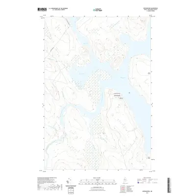
2021 Map of Chesuncook
USGS Topo · Published 2021About this map
Chesuncook stands as a primary focal point at the intersection of the West Branch Penobscot River and Chesuncook Lake. This settlement, once a hub for North Woods logging operations, is documented here with its residential footprint and the Chesuncook Village Cem positioned near Graveyard Point. The surrounding landscape is defined by an intricate network of waterways and wetlands, including Brandy Pond, Black Pond, and the serpentine courses of Pine Stream and Little Ragmuff Stream.
Find a feature on this map
16 named features on this map. Tap any name to fly to it.
Don’t see what you’re looking for? This feature index may not catch every label — zoom into the map to look around manually.
Map Details
Editions of this 2021 Chesuncook Map
This is the sole edition of this map. No revisions or reprints were ever made.
Other maps of this area

1954 · Chesuncook
USGS Topo · 1:62,500

1954 · North East Carry
USGS Topo · 1:62,500

1954 · Caucomgomoc Lake
USGS Topo · 1:62,500

1954 · Grant Farm
USGS Topo · 1:62,500

1954 · Presque Isle
USGS Topo · 1:250,000

1954 · Millinocket
USGS Topo · 1:250,000

1958 · Presque Isle
USGS Topo · 1:250,000

1958 · Millinocket
USGS Topo · 1:250,000

1958 · Chesuncook
USGS Topo · 1:62,500

1958 · Caucomgomoc Lake
USGS Topo · 1:62,500