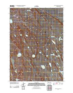
2011 Map of Chicago Valley
USGS Topo · Published 2011About this map
Chicago Valley defines this high desert landscape of Lake County, Oregon, where water management is the primary marker of human presence. Named water sources such as Juniper Waterhole, Musser Waterhole, and Webster Waterhole dot the terrain, indicating the critical nature of these points for ranching or local survival in an arid environment. The map shows a sparse network of infrastructure centered around Chicago Valley Rd and BLM Road 6121-0-B0, which provide access to more isolated features like Hidden Lake and Parachute Pond. The presence of labels like False Waterhole and One Crock Waterhole suggests a specific local history of surveying and land use where the naming of every depression or catchment was essential for navigating the basin floor.
Find a feature on this map
11 named features on this map. Tap any name to fly to it.
Don’t see what you’re looking for? This feature index may not catch every label — zoom into the map to look around manually.
Map Details
Editions of this 2011 Chicago Valley Map
This is the sole edition of this map. No revisions or reprints were ever made.
Other maps of this area

1955 · Crescent
USGS Topo · 1:250,000

1957 · Crescent
USGS Topo · 1:250,000

1958 · Crescent
USGS Topo · 1:250,000

1970 · Crescent
USGS Topo · 1:250,000
1981 · Tired Horse Butte
USGS Topo · 1:24,000

1981 · Sand Rock
USGS Topo · 1:24,000

1981 · Moonlight Butte
USGS Topo · 1:24,000

1981 · Elk Butte
USGS Topo · 1:24,000
1981 · Rams Butte
USGS Topo · 1:24,000

1981 · Chicago Valley
USGS Topo · 1:24,000