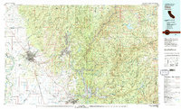
1980 Map of Chico
USGS Topo · Published 1980About this map
The city of Chico and its surrounding Sacramento Valley agricultural lands meet the rising Sierra Nevada foothills in this 1980 survey. The landscape is defined by the transition from the flat plains near the Sacramento River to the deeply incised canyons of the Feather River and its various forks. Notable infrastructure includes the expansive Lake Oroville, which serves as a central hub for water management and recreation within the Lake Oroville State Recreation Area.
Find a feature on this map
118 named features on this map. Tap any name to fly to it.
Don’t see what you’re looking for? This feature index may not catch every label — zoom into the map to look around manually.
Map Details
Editions of this 1980 Chico Map
2 editions found
Other maps of this area

1886 · Honey Lake
USGS Topo · 1:250,000

1886 · Lassen Peak
USGS Topo · 1:250,000

1888 · Marysville
USGS Topo · 1:125,000

1888 · Smartsville
USGS Topo · 1:125,000

1888 · Bidwell Bar
USGS Topo · 1:125,000

1890 · Red Bluff
USGS Topo · 1:250,000

1891 · Bidwell Bar
USGS Topo · 1:125,000

1891 · Chico
USGS Topo · 1:125,000

1891 · Downieville
USGS Topo · 1:125,000

1891 · Honey Lake
USGS Topo · 1:250,000