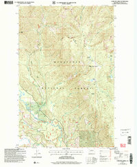
2004 Map of Chikamin Creek
USGS Topo · Published 2008About this map
Wenatchee National Forest spans this high-elevation landscape, where the Entiat Mountains dominate the horizon. In this mid-2000s study, the drainage patterns of the Chiwawa River and its tributaries, such as Chikamin Creek and Minnow Creek, reveal the complex geography used by seasonal campers and backcountry travelers. The presence of Huckleberry Ford and the Minnow Creek Road suggests historical transit routes through the timber, while a solitary mine near the southern edge indicates the area's mineral interests.
Find a feature on this map
40 named features on this map. Tap any name to fly to it.
Don’t see what you’re looking for? This feature index may not catch every label — zoom into the map to look around manually.
Map Details
Editions of this 2004 Chikamin Creek Map
This is the sole edition of this map. No revisions or reprints were ever made.
Other maps of this area

1901 · Chiwaukum
USGS Topo · 1:125,000

1902 · Stehekin
USGS Topo · 1:125,000

1904 · Stehekin
USGS Topo · 1:125,000

1904 · Chiwaukum
USGS Topo · 1:125,000

1944 · Holden
USGS Topo · 1:62,500

1944 · Lucerne
USGS Topo · 1:62,500

1949 · Lucerne
USGS Topo · 1:62,500

1949 · Holden
USGS Topo · 1:62,500

1955 · Concrete
USGS Topo · 1:250,000

1957 · Wenatchee
USGS Topo · 1:250,000