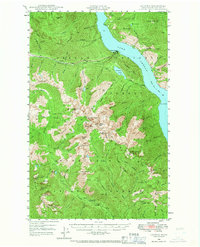
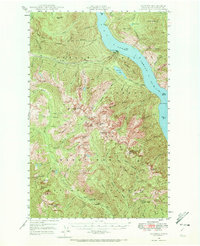
1944 Map of Lucerne
USGS Topo · Published 1966About this map
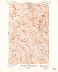
Lake Chelan serves as the central artery of this 1944 survey, where the only transit to remote outposts like Lucerne and Moore is the designated Steamer Route to Chelan. This reliance on water transport defines the era's mountain life, connecting isolated settlements to the world beyond the Entiat Mountains. Further inland, the map captures the labor-intensive management of the Wenatchee National Forest, shown through sites like the Cottonwood Guard Sta and Cedar Camp. The topography is defined by high alpine features such as Cardinal Peak and Milham Pass, while industrial activity is represented by the Edit Mine near Railroad Creek. The drainage patterns are complex, with Domke Falls and numerous glacial lakes like Myrtle Lake and Larch Lakes feeding the river systems during this mid-century period of forestry and mineral exploration.
Find a feature on this map
80 named features on this map. Tap any name to fly to it.
Don’t see what you’re looking for? This feature index may not catch every label — zoom into the map to look around manually.
Map Details
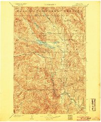
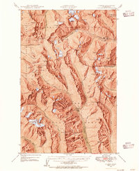
Editions of this 1944 Lucerne Map
3 editions found

Other maps of this area

1899 · Methow
USGS Topo · 1:125,000

1901 · Chelan
USGS Topo · 1:125,000

1901 · Methow
USGS Topo · 1:125,000

1901 · Chiwaukum
USGS Topo · 1:125,000

1902 · Stehekin
USGS Topo · 1:125,000

1904 · Stehekin
USGS Topo · 1:125,000
1904 · Chiwaukum
USGS Topo · 1:125,000
1944 · Holden
USGS Topo · 1:62,500

1949 · Lucerne
USGS Topo · 1:62,500
1949 · Holden
USGS Topo · 1:62,500