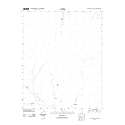
2011 Map of Chilchinbito Canyon
USGS Topo · Published 2011About this map
Chilchinbito Canyon defines the drainage patterns of this high-elevation landscape in the Chinle Agency region, where seasonal watercourses have carved a complex network of arroyos. The geography is characterized by a series of named washes, such as Pine Tree Wash and Black Rock Wash, which converge as they move through the arid terrain. One of the few established roadway connections is Indian Rte 9034, which crosses the southern portion of the area near the prominent landmark of Red Point. This 2011 survey by the U.S. Geological Survey captures the scarce but vital water sources essential to this environment, including Aspen Spring and the drainage of Yellow Jacket Wash. The map illustrates a landscape where named natural features like Aspen Grove Wash and Celebration Wash provide the primary points of orientation in a region with limited modern infrastructure.
Find a feature on this map
11 named features on this map. Tap any name to fly to it.
Don’t see what you’re looking for? This feature index may not catch every label — zoom into the map to look around manually.
Map Details
Editions of this 2011 Chilchinbito Canyon Map
This is the sole edition of this map. No revisions or reprints were ever made.
Other maps of this area

1883 · Marsh Pass
USGS Topo · 1:250,000

1892 · Marsh Pass
USGS Topo · 1:250,000

1892 · Canyon De Chelly
USGS Topo · 1:250,000

1954 · Shiprock
USGS Topo · 1:250,000

1956 · Marble Canyon
USGS Topo · 1:250,000

1958 · Shiprock
USGS Topo · 1:250,000

1959 · Shiprock
USGS Topo · 1:250,000

1959 · Marble Canyon
USGS Topo · 1:250,000

1961 · Marble Canyon
USGS Topo · 1:250,000
1968 · Toh Ne Zhonnie Spring
USGS Topo · 1:24,000