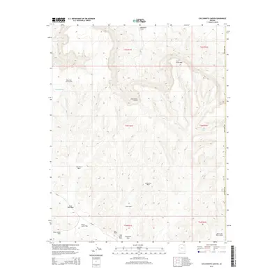
2014 Map of Chilchinbito Canyon
USGS Topo · Published 2014About this map
Chilchinbito Canyon dominates this high-altitude landscape of the Colorado Plateau, where a complex network of seasonal drainage channels carves through the sandstone. The terrain is defined by its deep canyons and rising prominences, notably Red Point in the southern reaches. Water sources are scarce and precious in this environment, represented here by Aspen Spring and several named washes that indicate the path of intermittent flows, including Aspen Grove Wash and the curiously named Pain in the Back Canyon.
Find a feature on this map
21 named features on this map. Tap any name to fly to it.
Don’t see what you’re looking for? This feature index may not catch every label — zoom into the map to look around manually.
Map Details
Editions of this 2014 Chilchinbito Canyon Map
This is the sole edition of this map. No revisions or reprints were ever made.
Other maps of this area

1883 · Marsh Pass
USGS Topo · 1:250,000

1892 · Marsh Pass
USGS Topo · 1:250,000

1892 · Canyon De Chelly
USGS Topo · 1:250,000

1954 · Shiprock
USGS Topo · 1:250,000

1956 · Marble Canyon
USGS Topo · 1:250,000

1958 · Shiprock
USGS Topo · 1:250,000

1959 · Shiprock
USGS Topo · 1:250,000

1959 · Marble Canyon
USGS Topo · 1:250,000

1961 · Marble Canyon
USGS Topo · 1:250,000
1968 · Toh Ne Zhonnie Spring
USGS Topo · 1:24,000