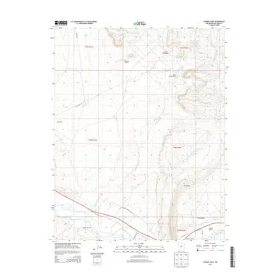
2013 Map of Chimney Rock
USGS Topo · Published 2013About this map
The Hogback dominates the southeastern quadrant of this San Juan County landscape, a distinctive geological ridge that separates the high desert plains from the San Juan River valley. Near the river, the settlement of Waterflow and the Jewett Valley area are defined by complex irrigation systems, including the Jewett Valley Ditch and the Hogback Canal, which have historically supported agriculture in this arid region. The presence of the Hogback Trading Post reflects the area's long-standing role as a center for local commerce and exchange.
Find a feature on this map
29 named features on this map. Tap any name to fly to it.
Don’t see what you’re looking for? This feature index may not catch every label — zoom into the map to look around manually.
Map Details
Editions of this 2013 Chimney Rock Map
This is the sole edition of this map. No revisions or reprints were ever made.
Other maps of this area

1889 · Chaco
USGS Topo · 1:250,000

1892 · Chaco
USGS Topo · 1:250,000

1927 · Sulphur Spring
USGS Topo · 1:96,000

1928 · Kirtland
USGS Topo · 1:125,000

1932 · Kirtland
USGS Topo · 1:125,000

1934 · Chimney Rock
USGS Topo · 1:62,500

1936 · Chimney Rock
USGS Topo · 1:62,500

1954 · Shiprock
USGS Topo · 1:250,000

1958 · Shiprock
USGS Topo · 1:250,000

1959 · Shiprock
USGS Topo · 1:250,000