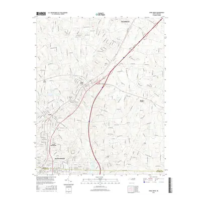
2016 Map of China Grove
USGS Topo · Published 2016About this map
China Grove and Landis anchor a corridor of steady development along the Us 29 and I-85 routes, reflecting the modern expansion of the Piedmont region. This 2016 survey shows the transition from the denser street grids of northern Kannapolis to the more open residential and rural landscapes of Bostian Heights and Five Forks. The terrain is defined by a series of north-south flowing waterways, including Grants Creek and Cold Water Creek, which divide the gently undulating topography. Local aviation history is represented by Wilhelm Airport and Sloop Airport, while several significant burial grounds, such as China Grove Cemetery and West Lawn Memorial Park, provide essential data for genealogical research. Small reservoirs like Lake Corriher and Lake Fisher punctuate the landscape, serving as both utility and community focal points in this part of Rowan and Cabarrus counties.
Find a feature on this map
30 named features on this map. Tap any name to fly to it.
Don’t see what you’re looking for? This feature index may not catch every label — zoom into the map to look around manually.
Map Details
Editions of this 2016 China Grove Map
This is the sole edition of this map. No revisions or reprints were ever made.
Other maps of this area

1893 · Statesville
USGS Topo · 1:125,000

1941 · Charlotte
USGS Topo · 1:125,000

1942 · Charlotte
USGS Topo · 1:125,000

1949 · Kannapolis
USGS Topo · 1:24,000

1950 · Concord
USGS Topo · 1:24,000

1953 · Charlotte
USGS Topo · 1:250,000

1954 · Charlotte
USGS Topo · 1:250,000

1957 · Mount Pleasant
USGS Topo · 1:62,500

1960 · Charlotte
USGS Topo · 1:250,000

1962 · Charlotte
USGS Topo · 1:250,000