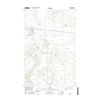
2017 Map of Chinook
USGS Topo · Published 2017About this map
Chinook serves as the regional hub on this northern Montana landscape, situated where the Milk River valley transitions into the surrounding coulees and plains. The town is structured by a grid of streets including Missouri St, Pennsylvania St, and Minnesota St, with the Edgar G Obie Airport located on the western edge. A complex system of water management is evident through the presence of the Matheson Ditch and Hillside Ditch, which parallel the river's course to support the local agricultural economy. The terrain is deeply incised by numerous seasonal drainages such as Threemile Coulee, Black Coulee, and Sixmile Coulee. To the north, the confluence of Lodge Cr and Battle Cr feeds into the river system, while named landforms like Sharnikon Gulch and Lonetree Coulee provide distinct geographic markers across the prairie.
Find a feature on this map
50 named features on this map. Tap any name to fly to it.
Don’t see what you’re looking for? This feature index may not catch every label — zoom into the map to look around manually.
Map Details
Editions of this 2017 Chinook Map
This is the sole edition of this map. No revisions or reprints were ever made.
Other maps of this area

1904 · Yantic
USGS Topo · 1:62,500

1904 · Chinook
USGS Topo · 1:62,500

1912 · Zurich
USGS Topo · 1:125,000

1953 · Havre
USGS Topo · 1:250,000

1956 · Lloyd
USGS Topo · 1:62,500

1956 · Cleveland
USGS Topo · 1:62,500

1957 · Havre
USGS Topo · 1:250,000

1958 · Havre
USGS Topo · 1:250,000

1964 · Rabbit Hills
USGS Topo · 1:24,000

1964 · Telescope Coulee
USGS Topo · 1:24,000