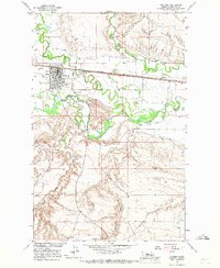
1964 Map of Chinook
USGS Topo · Published 1967About this map
The county seat of Chinook serves as a vital hub for Montana’s high plains, defined by the winding course of the Milk River and a sophisticated network of irrigation systems. In the mid-1960s, the town’s economy is visibly tied to both agriculture and industry, featuring an Oil Refinery and numerous Gravel Pits alongside the tracks of the Great Northern railroad. The landscape is etched with complex water management features like the Fort Belknap Canal, Paradise Valley Canal, and Matheson Ditch, which support the surrounding valley floor.
Find a feature on this map
28 named features on this map. Tap any name to fly to it.
Don’t see what you’re looking for? This feature index may not catch every label — zoom into the map to look around manually.
Map Details
Editions of this 1964 Chinook Map
This is the sole edition of this map. No revisions or reprints were ever made.
Other maps of this area

1904 · Yantic
USGS Topo · 1:62,500

1904 · Chinook
USGS Topo · 1:62,500

1912 · Zurich
USGS Topo · 1:125,000

1953 · Havre
USGS Topo · 1:250,000

1956 · Lloyd
USGS Topo · 1:62,500

1956 · Cleveland
USGS Topo · 1:62,500

1957 · Havre
USGS Topo · 1:250,000

1958 · Havre
USGS Topo · 1:250,000

1964 · Rabbit Hills
USGS Topo · 1:24,000

1964 · Telescope Coulee
USGS Topo · 1:24,000