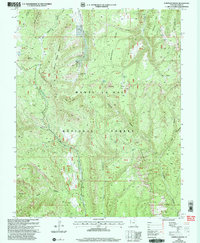
2001 Map of Chippean Rocks
USGS Topo · Published 2004About this map
Manti-La Sal National Forest defines this high-elevation landscape in San Juan County, where the transition from mesas to deep canyons creates a complex network of natural landmarks and administrative boundaries. The map highlights the rugged topography around Maverick Point, where the Maverick Point Visitor Information Site stands as a focal point for the area. Transport and access are clearly delineated, including the remote Mormon Pasture Landing Strip and the winding route known as The Causeway. Geologic features dominate the view, from the jagged Reef of Rocks to the namesake Chippean Rocks. This survey also documents critical water sources in a dry environment, such as Sand Spring and the Flowing Well near Round Mountain, providing essential context for land use and movement through this part of the Colorado Plateau.
Find a feature on this map
48 named features on this map. Tap any name to fly to it.
Don’t see what you’re looking for? This feature index may not catch every label — zoom into the map to look around manually.
Map Details
Editions of this 2001 Chippean Rocks Map
This is the sole edition of this map. No revisions or reprints were ever made.
Other maps of this area

1886 · Abajo
USGS Topo · 1:250,000

1892 · Abajo
USGS Topo · 1:250,000

1893 · Abajo
USGS Topo · 1:250,000

1935 · Elk Ridge
USGS Topo · 1:96,000

1940 · Elk Ridge
USGS Topo · 1:125,000

1954 · Elk Ridge 4 NW
USGS Topo · 1:24,000

1954 · Elk Ridge 1 SW
USGS Topo · 1:24,000

1954 · Elk Ridge 2 SE
USGS Topo · 1:24,000

1954 · Elk Ridge 1 NW
USGS Topo · 1:24,000

1954 · Elk Ridge 1 NE
USGS Topo · 1:24,000